Riding into Civita feels like crossing a border that doesn't exist on any map. The people here are Arbëreshë — descendants of Albanian settlers who arrived five centuries ago and never stopped speaking the old language.
The sign at the entrance to the village reads both in Italian and in Arbërisht — an archaic form of Albanian spoken here since the 1470s, when Albanian communities fled the Ottoman conquest and settled in southern Italy. In Civita they call the village Çifti, which means "nest of eagles." Looking up at the rock face above the town, you understand why.
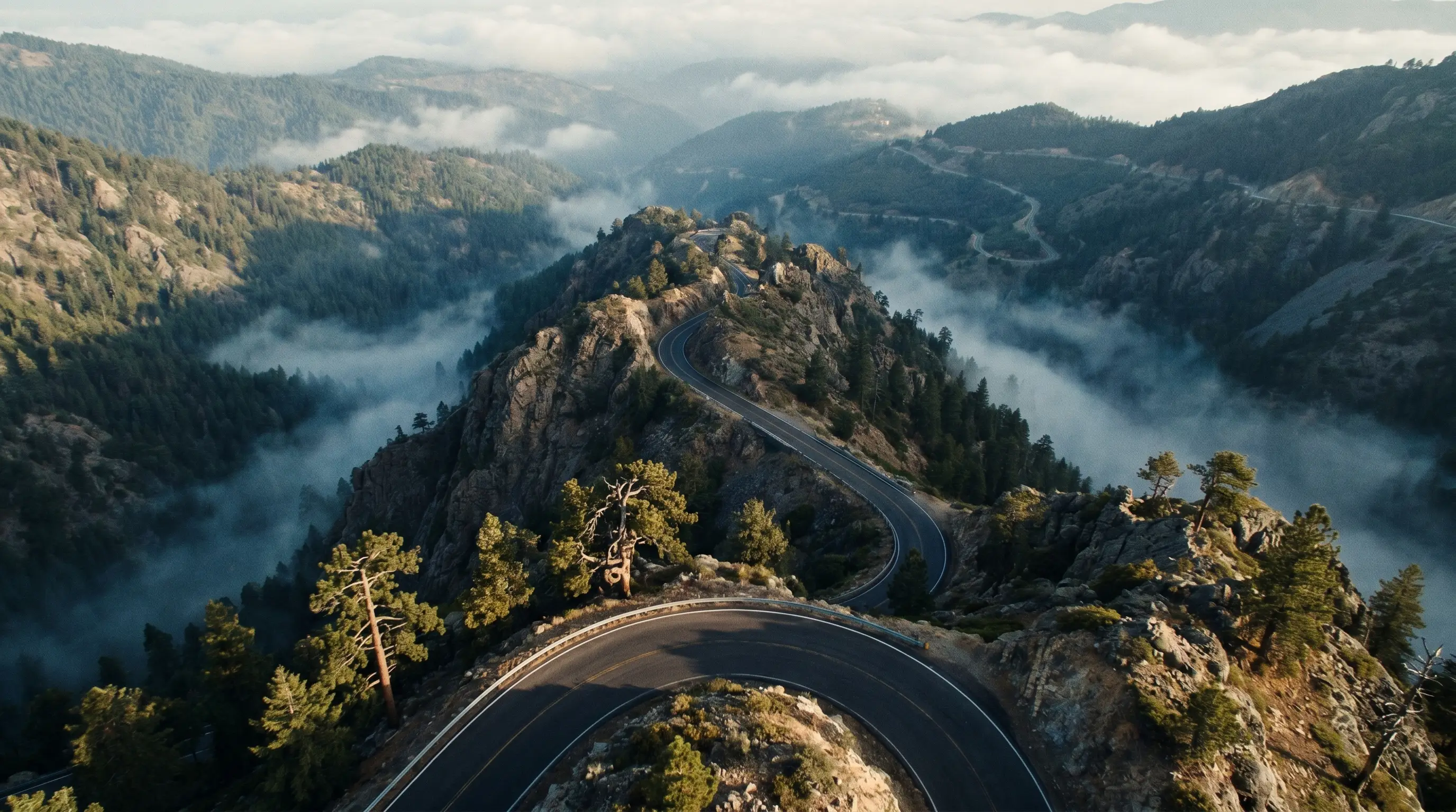
The road into Civita descends through a series of switchbacks cut into the limestone cliff. Below the town, the Raganello gorge opens up — 700 metres of vertical walls carved by the river over millions of years. The Canyon del Raganello is one of the deepest in Italy, and one of the few completely unknown to international visitors.
The Arbëreshë
There are 50 Arbëreshë communities in southern Italy — in Calabria, Sicily, Basilicata, Campania and Molise. They arrived in several waves between 1470 and 1540, following the death of their leader Gjergj Kastrioti Skanderbeg and the subsequent Ottoman consolidation of Albania. The Italian government gave them land in depopulated mountain villages. They built churches in the Byzantine rite and schools where the old language was taught.
In Civita, the language is still alive. Children speak it. The street signs are bilingual. The museum — Museo della Cultura Arbëreshë — occupies a building in the main square and tells the story of the diaspora through photographs, costumes and documents.
"This is not folklore. This is a living community that has maintained its identity for 550 years, on a cliff in Calabria, speaking a language that no longer exists anywhere in Albania."
— Davide De Caro, SudRidersThe Ponte del Diavolo
Below Civita, a trail descends 300 metres into the gorge to the Ponte del Diavolo — the Devil's Bridge, a medieval stone arch spanning the Raganello at the point where the canyon narrows to six metres wide. The bridge is accessible on foot in about 40 minutes from the village. The riding to Civita takes care of the rest.
Civita sits on the Parks of the South route, Day 2. After the Pollino overnight at Campotenese, the road descends to Castrovillari — the "gateway to the park" — and then climbs again to Civita on the SP263. Allow 90 minutes including the stop at the gorge viewpoint.
The riding in this area rewards patience. The roads are small and occasionally unmarked. The GPS will suggest faster alternatives. Ignore it. The SS92, the SP263 and the descent into San Lorenzo Bellizzi are the kind of roads that remind you why you brought a motorcycle instead of a car.
Civita is one stop on the Parks of the South tour. The full route — Salerno to Villa San Giovanni, three days, 860 km — covers Pollino, Sila and Aspromonte. The Day 2 route sheet includes Civita, the Raganello gorge and the descent to Camigliatello Silano.